| Highfield Residents' Association |
|
The Character of Highfield
Some of us have clocked up a good many years in Highfield, but what do we know about the area and the historical processes that have shaped its character? Looking around us, what can we deduce about its past?
Try out these questions: answers at the end of this piece.
- Why is it called Highfield?
- When was London Road built? What route had coaches to London taken till that time?
In 2015, in preparing for the Headington Neighbourhood Plan, Headington was divided into nineteen areas, of which Highfield was one, and for each area an evidence-based ‘Character Assessment’ had to be carried out and submitted.
You will find the final edited version of the Highfield character assessment here.
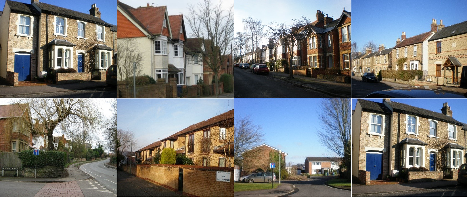
The Highfield Character Assessment was undertaken by Gillian Beeston and Hilary Rollin. Since the Character Assessments of the different areas of Headington, compiled by different people, required some uniformity, we were given training and a toolkit to enable us to carry out a street-by-street survey and submit our document complete with photographs. Gill and Hilary were required to record what they saw, the features making each street recognisable and distinctive; what contributes positively to our experience and what does not, the busyness of a specific street, features and activities that are constantly evolving. This meant looking at places at different times of day, at the structures we impose on our landscape: buildings that are merely functional, others that are of architectural or cultural interest, their materials, roofs, façades, the level of property maintenance, boundaries, walls, hedges, verges, trees in gardens and along the pavements, street furniture, community amenities, public areas, open spaces, views, fields, the physical features of the terrain, geology, topography, drainage, ecology and wildlife, ambiance, air quality. In short, anything pertaining to the local surroundings and the materials defining the characteristics of Highfield. As a result our streets and open spaces were seen in a new light, with repeated features observed and noted as characteristic of a given street or the entire area. One outstanding feature was that whereas some areas of Headington are predominantly uniform, Highfield‘s distinguishing characteristic is its great variety.
The underlying purpose of this observation of the features of Highfield, and its contribution to Headington was the need to gain an understanding of each area’s character and identity in a way that can help fashion the future of Headington, to develop policy to protect it or inform change. HRA found this project, one of many topics covered in the Headington Neighbourhood Plan, so fascinating that once the report was finished, we decided to share the information and knowledge gained, hence the talk given to HRA members in 2017. This was well attended and resulted in residents contributing further information and anecdotes about our area. See also the report in the HRA Newsletter of Spring 2018.
To see all the Character Assessments of Headington look here and to learn about the history of Headington, see Stephanie Jenkins’s wonderfully informative work here.
Answers to the two questions:
The High Field was one of the four great fields of Headington.
London Road was built in the 1770s. Until that time, London-bound coaches made their way up Headington Hill, branched right into Cheney Lane, then onto what became Old London Road, and subsequently Old Road.
